COOL WAYS ALWAYS


Explore the beauty of Pakistan!


Foothills of Himalaya, Crystal clear water, Cool breeze, 


Clear blue sky, Snow caped mountains, Green grazes, Giant 


glaciers, Lush green meadows and tense free peaceful 


atmosphere awaiting for You.


Join us for seeing such heavenly scenic places at 


very Economical budget!


COMING TOUR  21st OCTOBER, 2011


MUREE and NARAN Tour:
     
10 days Special Package just for Rs. 15,000/- Per Person.
Free Hotel accomodation and Food.
(From Karachi)


Destinations:
Islamabad
Murree
Neelam Point(Neelam River)

Balakot

Kaghan

Kiwai

Soghran

Naran

Lake Saif-ul-Mulook

Lalazar

.

Contact:

Syed Imran: 

03062419900


Poonch


LOCATION:
Poonch district borders Indian-administered Kashmir that comes under the Kashmir section which is part of the greater dispute between India and Pakistan.

Description:

Poonch is one of the scenic  valleys in Azad Kashimr. Poonch is one of the eight districts of Azad Jammu and Kashmir. The capital of the district is Rawalakot with the Awan, Douli, Maldial and Sudhan tribes being the dominant groups in the district. This region has produced numerous business, political and military leaders.

History:

From the end of the 17th century up to 1837 A.D Poonch was ruled by different Muslim Rajas of Loran. It then fell in to the hands of Raja Falz Talab Khan of Rajori. In 1846, this area was handed over to Maharaja Ghulab Singh under the Treaty of Amritsar. Before this transfer, Poonch was considered a district of Lahore. Maharaja Ghulab Singh handed over Poonch and some other areas to his nephews, Jawahar Singh and Moti Singh, with the condition that they would not make any administrative change without the consent of the Maharaja of Kashmir. Poonch was annexed and converted Into Jagir by Maharaja Han Singh in 1935-36 by the deposing Raja of Poonch the Dogras always found it difficult to establish their rule in Poonch.


In 1947 when Pakistan came into being, the people of Poonch started an armed struggle against the Dogra and Indian forces and got the area liberated which now administratively stands divided into three districts namely Poonch, Sudhnuti and Bagh.

Separation of Poonch:

After independence in 1947, Pakistan and India fought a War over Kashmir. As a result of the war, Poonch was split between the two nations. Prior to the division of Poonch, the only high school in the district was in the city of Poonch, this city now forms the capital of Indian-controlled Poonch.

Places to See:

Rawalakot:

Rawalakot the district headquarter, is situated in the heart of district Poonch is also called Pearl Valley. The altitude of this beautiful saucer-shaped valley is 1615 meters. Situated at a distance of 76 kilometers from Kohalla, it is also linked with Rawalpindi/Islamabad via Azad pattan and Dhalkot and with Muzaffarabad via Kohalla by black top roads.

Rawalakot offers very pleasant climate during the summer. In Rawalakot, some good hotels and private guest houses provide comfortable accommodation. Here the tourism industry is growing with the increasing collaboration of public-private efforts. The central location of Rawalakot in AJK, its pleasant climate and easy access from other regions makes it a favorite tourist destination. The improvement of transportation arid telecommunication sectors have further contributed to its potential for tourism.


The construction of Guoien Nullah road between Rawalakot and Azad pattan has considerably reduced the distance and journey time. During summer the place becomes full of green grass and beautiful flowers including many varieties of roses. The town has few good bazaars where all essential commodities of life are easily available.


In Rawalakot, besides tourist rest house and circuit house, some good hotels and private guest houses provide comfortable accommodation.

These places portray rich inherent natural beauty encompassing all others while awaiting visitors for a comfortable stay. There are of a few private rest houses on the way to Banjosa from Rawalakot also Ghorimar is situated 20 kms from Khaigala awaiting ones arrival to explore the fascinating beauty over-looking the sub-valley of Rawalakot and Bagh Accommodation on reasonable rates is available here in Tourism, PWD and Pearl Development Authority’s rest houses.

Kot Muttay Khan:

It is situated on the main Rawalakot -Mang road near Topa, The site is located at a high altitude and allows visitors to enjoy cool and comfortable atmosphere during summer. One can have a nice over view of the adjoining valleys from this point.

Chape-ni-Dahar(Gulshan-e-Shuhda): 

The place is located on the outskirts of Rawalakot (4 kms) on the main Rawalakot-Banjosa road. The site offers comfortable climate arid tranquil atmosphere during the summer. It also possesses historical archaeological importance as an abandoned old temple exists here. The renovation and preservation of the said temple can increase the interest of the visiting researchers and tourist.

Dara Sher Khan:

The village of Dara Sher Khan is located 8 kilometres (5.0 mi) from Tatapani and is located near Goi, Bhabra and Sehra. It was named by Sardar Sher Khan. Two main tribes live there: the Great Dullies and the Gujars. Others castes like the Saadat Bhati also live there. Many government officers and doctors come from Dara Sher Khan. The village's literacy rate is relatively high. There are 11 primary schools, 2 high schools in the government sector, 2 public schools, 4 village development organizations, more than 30 companies, and 4 farmer associations.

Sehra:

Sehra is located 7 kilometres (4.3 mi) from Tatapani on Poonch Road. A crossing point is also located here.


Paniola:

Paniola is situated 17 KMs from Rawalakot towards Kohalla and 52 kilometers from Kohalla. Due to its calm and charming characteristics, the Tourism Department has constructed a rest house for tourists.

Banjosa / Chottagala:

It is Situated 20 kilometers from Rawalakot, at an altitude of 1981 meters. Its scenic beauty and impressive surrounding is compelling and attracts tourists to reach here to enjoy the nature for a possible comeback. Amidst the captivating beauty of Banjosa the artificial lake reflects the dense forest standing along the surrounding of of the resting calm waters of Banjosa lake.

The nearby worth seeing areas of Banjosa are Jandali, Hussain kot and Devi gali which can't be simply bypassed for a pleasure trip. The distance parting the destinations from Banjosa are 3 kms, 4kms and 12 kms respectively. These places portray rich inherent natural beauty encompassing all others while awaiting visitors for a comfortable stay. Also, Ghorimar is situated 20 kms from Khaigala awaiting ones arrival to explore the fascinating beauty over-looking the sub-valley of Rawalakot and Bagh.

Accommodation on reasonable rates is available here in Tourism, PWD and Pearl Development Authority's rest houses.

Koyian:

From Rawalakot 17 kilometers ahead this place is surrounded by dense forests, which makes it charming and pleasant. A Tourist Rest House has been constructed by AJK Tourism Department for the tourists. The place enables the tourist to have an easy access to Banjosa which is 5 kms ahead.
Ghori Mar:
Ghori Mar is situated at a distance of 30 kilometers. Ahead of Rawalakot, a fair-weather road via Khaigala leads to this place. At reaching Ghori Mar, one can explore the fascinating beauty over-looking the sub valleys of Rawalakot and Bagh. AJK Tourism Department provides accommodation facilities to visitors.
Tolipir:
The road from Ghori Maar leads to Tolipir a place that offers calm atmosphere with vast green meadows stretching over a big area a big area. The place holds the potential to mesmerize visitors.


Tatta Pani:
Tatta Pani is situated on the right bank of the river Poonch, at a distance of 29 kilometers from Hajeera and is connected with two fair weather roads i.e. via Hajeera-Mandol and Balouch-Pakhonar road. It can be also be reached from Kotli, the district headquarter of Kotli district, by covering a distance of 26 kilometers. Tatta Pani is famous for its sulpher water springs. During winter season a large number of people visit this place daily to have hot water bath for the cure of skin and rheumatic ailments.


AJK Tourism Dept. has constructed Tourist Lodge arid bathrooms for the convenience of the visitors here. Transport services for Tatta Pan are available in good number from all important points of the Poonch, Mirpur & Kotii districts of Azad Kashmir.
Jandala:
Jandala is a village in the Rawalakot Tehsil of the Poonch District of Azad Kashmir (the area of Kashmir administered by Pakistan). It is in the north east of the district, in the hills above the Jehlum Valley. The district was affected by a major earthquake (7.6 on the Richter scale) in October 2005, and suffered from flooding in July 2006.
The main language spoken is Pahari. Schools are the Jandala District High School, the Government Public School of Jandala and the Fatima jinnah college for girls. Usually the population is served by the Arja Rural Health Center in Bagh. The main export of Jandala is chewing tobacco. The most common drink is chai.
Poonch River:
The Poonch River is a river in Jammu and Kashmir, India and Azad Kashmir in Pakistan. It originates in the western foothills of Pir Panjal range, in the areas of Neel-Kanth Gali and Jamian Gali. It is called 'Siran' in this area. It flows to the north west. At first flowing southwards it enters Mangla Lake near Chomukh. The towns of Poonch, Sehra, Tata Pani and Kotli are situated on the banks of this river.

Sudhnoti


Location:
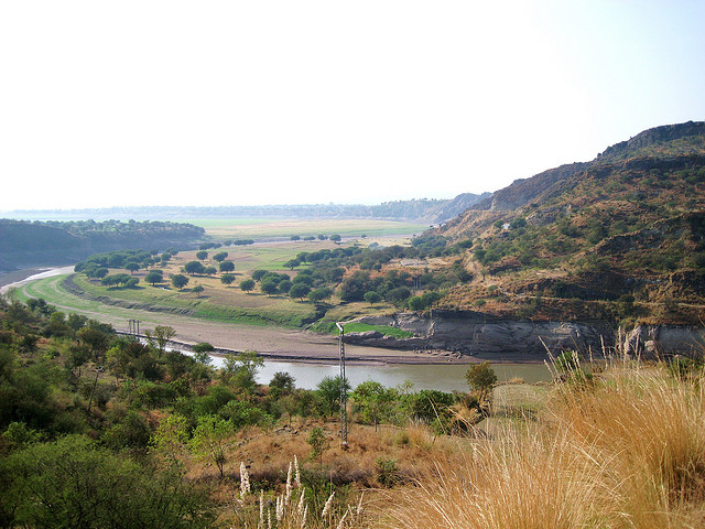
The Sudhnoti district of Azad Kashmir is bounded by Rawalakot District in the north, Kotli in the south and Pakistan in the west.

Climate:
Temperature in summer is almost 20 to 35 °C and in winter -5 to 25 °C. In winter, one may see snow on the nearby mountains.

Description:
Sudhnati is one of the eight districts of Azad Jammu and Kashmir in Pakistan. It comes under the Kashmir section which is part of the greater dispute between India and Pakistan. Sudhanoti was carved out of Poonch district in 1995. The total area of the district is 569 square kilometers, with a population of 214,000 in 1998. The district is divided into three tehsils these are:

Pallandri
Mang
Trarkhel

Population:
Sudhanoti has a population of 242,000. The majority of people living in this area are mostly members of the Sudhan and Awan tribes.

Places to See:
Pullandri:
Pallandri is a small town, situated in the Sudhnati District, in Azad Kashmir, Pakistan. It was the first capital of Azad Kashmir and is about 94 kilometres away from - the capital of Pakistan. Pallandri was tehsil of Poonch District, until the district was split into Poonch and Sudhnati.

Sometimes, the town's new name of Sudhnuti is still used but mostly people use its old name Pallandri. Pallandri is now the capital of Sudhnutti District. It is at an elevation of 1372 meters and is at a distance of 97 kilometers from Rawalpindi via Azad Pattan, and is also connected with Rawalakot by 64 kilometers long metalled road.
Pallandri  town has a hilly landscape and many historical forts.There is a PWD Rest House located at the hilltop, giving a wonderful view of the picturesque landscape and green mountains all round. All the basic facilities of life are available.

DC House:
One of the most known important and historical building in Pallandri is The DC House.(Currently Occupied by Amjad Pervaiz Ali Khan(DC)It was built in 1915 by Maraja Poonch, the then ruler of the Poonch State in Pallandri, he chose to put it on the very top of the town so he could see the Million Dollar view. It is built entirely out of stone so during the 2005 earthquake it wasn't harmed in any way whatsoever. It was known as Rani ka bangla/dak bangla the Maraja and his wife/Rani used to stay here while on thier way from Poonch to Rawalpindi. After the partition of India and Pakistan, in 1947, this Poonch state was also divided into two parts, one of them is in the Jammu and Kashmir (Indian held Kashmir) and the second part in the Azad Jammu and Kasmir (AJK). It was then converted into the DC house were the DC started to live and since that day, It was known as The DC house.

Tararkhal:   
With an altitude of 1982 meters, Tararkhal is situated at a distance of 211 kilometers from Rawalpindi via Kohala and 129 kilometers via Azad Pattan. It is a nice small station for tourists. Here PWD Rest House provides Spartan accommodation facilities. Essential commodities of daily use are also available from local bazaar.                 

Aliabad:
Aliabad is situated at an altitude of about 2134 meters, is at a distance of 50 kilometers from Pullandri and 112 kilometers from Rawalakot. This place is surrounded by thick, mixed forests of Deodar, blue pine and Fir.

Bus service is available both from Rawalakot to Abbasspur and Rawalpindi to Kahuta. From Kahuta onwards journey by jeep is advisable.